


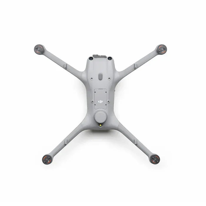
DJI Matrice 4D Drone with DJI RC Plus 2
DJI Matrice 4D Drone with DJI RC Plus 2
SKU:
- Wide-Angle Camera: 4/3 CMOS 20MPEffective Pixels Mechanical Shutter
- Medium Tele Camera: 48MP Effective Pixels f/2.8 70mm Format Equivalent
- Tele Camera: 48MP Effective Pixels f/2.8 168mm Format Equivalent
- Laser Range Finder: Measurement Range: 1800 m (1 Hz); Oblique Incidence Range (1: 5 Oblique Distance): 600 m (1 Hz)
- High Performance Drones: The all-new water and dust-resistant DJI Matrice 4D and 4TD are specifically designed for DJI Dock 3
Couldn't load pickup availability
Specs
Specs
General
| Weight | Approx. 1850 g (Includes battery, propellers, microSD card, no third-party payloads. Actual weight may vary due to materials or external factors.) |
| Max Takeoff Weight | 2090 g |
| Dimensions | 377.7 × 416.2 × 212.5 mm (L × W × H, without propellers) |
| Wheelbase | Diagonal: 498.5 mm Front Motor L-R: 383.0 mm Rear Motor L-R: 343.0 mm Front-Rear: 341.6 mm |
| Max Ascent Speed | 6 m/s (Normal Mode) 10 m/s (Sport Mode) |
| Max Descent Speed | 6 m/s (Normal Mode) 8 m/s (Sport Mode) |
| Max Horizontal Speed | Normal Mode (Obstacle Sensing Enabled): 15 m/s forward, 12 m/s backward, 10 m/s sideways Sport Mode: 21 m/s forward, 19 m/s backward, 15 m/s sideways (When used with DJI Dock, only Normal Mode is supported.) |
| Max Wind Speed Resistance | 12 m/s (during operation, takeoff, or landing) |
| Max Takeoff Altitude | 6500 m |
| Max Flight Time | 54 minutes (Measured at 12 m/s forward flight in a windless lab at 20 m ASL, Obstacle Avoidance Off, from 100% to 0% battery. Results vary.) |
| Max Hovering Time | 47 minutes (Measured hovering at 20 m ASL from 100% to 0% battery in windless conditions. Results vary.) |
| Max Operating Radius | 10 km (Approx. 25°C, safe battery level 15%, no wind, flight speed ~15 m/s, ~18 min hover. Results vary.) |
| Max Flight Distance | 43 km (Measured at 16 m/s in a windless environment at 20 m ASL, 100% to 0% battery. Results vary.) |
| Max Pitch Angle | 25° (Normal Mode), 30° (Sport Mode) |
| Max Angular Velocity | 200°/s |
| Global Navigation Satellite System | GPS + BeiDou + Galileo + QZSS + GLONASS (QZSS & GLONASS available only with RTK enabled.) |
| Hovering Accuracy Range | Vertical: ±0.1 m (Vision), ±0.5 m (GNSS), ±0.1 m (RTK) Horizontal: ±0.3 m (Vision), ±0.5 m (GNSS), ±0.1 m (RTK) |
| Operating Temperature | -20° to 50° C (-4° to 122° F) |
| Ingress Protection Rating | IP55 |
| Motor Model | 2611 |
| Propeller Model | 1364F foldable low-noise anti-ice propellers |
| RTK Module | Integrated |
| Beacon | Integrated |
Cameras
| Image Sensor | Wide-Angle: 4/3 CMOS, 20 MP Medium Tele: 1/1.3-inch CMOS, 48 MP Tele: 1/1.5-inch CMOS, 48 MP |
| Lens |
Wide-Angle FOV: 84°; 24 mm equivalent; f/2.8–f/11; Focus: 1 m–∞ Medium Tele FOV: 35°; 70 mm equivalent; f/2.8; Focus: 3 m–∞ Tele FOV: 15°; 168 mm equivalent; f/2.8; Focus: 3 m–∞ Lens Defogging: Supported on wide-angle, medium tele, and tele |
| ISO Range |
Normal Mode: ISO 100–25600 Night Scene Mode Wide-Angle: ISO 100–204800 Medium Tele: ISO 100–409600 Tele: ISO 100–409600 |
| Shutter Speed | Wide-Angle: Electronic 2–1/8000 s, Mechanical 2–1/2000 s Medium Tele: 2–1/8000 s Tele: 2–1/8000 s |
| Max Image Size | Wide-Angle: 5280×3956 Medium Tele: 8064×6048 Tele: 8192×6144 |
| Minimum Photo Interval | 0.5 s |
| Still Photography Modes |
Wide-Angle: Single (20 MP), Timed, Smart Capture, Panorama Medium Tele: Single (12/48 MP), Timed, Smart Capture Tele: Single (12/48 MP), Timed, Smart Capture |
| Video Codec and Resolution | H.264 / H.265, CBR or VBR 4K: 3840×2160@30fps FHD: 1920×1080@30fps |
| Video Bitrate | H.264: 60 Mbps H.265: 40 Mbps |
| Supported File System | exFAT |
| Photo Format | Wide-Angle: JPEG/DNG (RAW) Medium Tele: JPEG Tele: JPEG |
| Video Format | MP4 (MPEG-4 AVC/H.264) |
| Digital Zoom | Tele Camera: 16x (112x hybrid) |
Gimbal
| Stabilization | 3-axis mechanical (tilt, roll, pan) |
| Mechanical Range | Tilt: -140° to +50° Roll: -52° to +52° Pan: -65° to +65° |
| Controllable Range | Tilt: -90° to +35° Pan: Not controllable |
| Max Control Speed (Tilt) | 100°/s |
| Angular Vibration Range | ±0.005° |
Sensing
| Sensing Type | Omnidirectional binocular vision + 3D infrared sensor (downward) |
| Forward | Measurement: 0.5–20 m Detection: 0.5–200 m Effective Speed: ≤15 m/s FOV: Horizontal 95°, Vertical 90° |
| Backward | Measurement: 0.5–20 m Effective Speed: ≤12 m/s FOV: Horizontal 95°, Vertical 90° |
| Lateral | Measurement: 0.5–16 m Effective Speed: ≤10 m/s FOV: Horizontal 90°, Vertical 90° |
| Upward | Measurement: 0.5–20 m Effective Speed: ≤6 m/s FOV: Front/Back 95°, Left/Right 90° |
| Downward | Measurement: 0.5–16 m Effective Speed: ≤6 m/s FOV: Front/Back 90°, Left/Right 95° |
| Operating Environment | Forward/Backward/Upward/Downward: Surfaces with clear patterns, lux >0.1 Lateral: Diffuse reflective surface >20% reflectivity, lux >6 |
Video Transmission
| System | DJI O4+ Enterprise |
| Live View Quality | 720p/30fps or 1080p/30fps (DJI RC Plus 2 Enterprise) 540p/30fps, 720p/30fps, 1080p/30fps (DJI Dock 3 & FlightHub 2) |
| Operating Frequency | 2.400–2.4835 GHz 5.150–5.250 GHz (CE: 5.170–5.250 GHz) 5.725–5.850 GHz (Availability varies by region; comply with local regulations.) |
| Max Transmission Distance | FCC: 25 km CE/SRRC/MIC: 12 km (Unobstructed, free of interference, one-way test.) |
| Max Transmission Distance (with interference) | Strong interference: 1.5–5 km Medium interference: 5–15 km Weak interference: 15–25 km |
| Max Download Speed | 20 MB/s (DJI Dock 3), 20 MB/s (DJI RC Plus 2 Enterprise) |
| Lowest Latency | ~100 ms aircraft to dock (environment-dependent), plus network factors dock to FlightHub 2 |
| Antenna | 8 antennas, 2T4R |
| Transmitter Power (EIRP) | 2.4 GHz: <33 dBm (FCC), <20 dBm (CE/SRRC/MIC) 5.1 GHz: <23 dBm (FCC/CE) 5.8 GHz: <33 dBm (FCC/SRRC), <14 dBm (CE) |
| Others | Supports DJI Cellular Dongle 2 (region-dependent) |
Storage
| Supported Memory Cards | U3/Class 10/V30 or above exFAT format recommended |
| Recommended microSD Cards | Lexar 1066x (64GB/128GB/256GB/512GB) Kingston Canvas Go! Plus (64GB/128GB/256GB/512GB) |
Battery
| Capacity | 6768 mAh |
| Voltage | 22.14 V |
| Max Charging Voltage | 25.5 V |
| Cell Type | Li-ion 6S |
| Chemical System | LiNiMnCoO2 |
| Energy | 149.9 Wh |
| Weight | 640 g |
| Cycle Count | 400 |
| Charging Temperature | 5° to 45° C (41° to 113° F) |
| Discharge Rate | 4C |
| Max Charging Power | 1.8C |
| Low-Temperature Charging | Supports self-heating charging |
Power Adapter
| Input | 100–240 V AC, 50/60 Hz, 3 A |
| Output Power | 240 W |
| Output | Total: Up to 240 W max USB-C Port: 65 W max (If two ports are used simultaneously, USB-C max is 45 W.) |
RC Plus 2 Enhanced Controller
| Operating Frequency Range* | 5.150-5.250 GHz; 5.725-5.850 GHz |
| Transmitter Power (EIRP) | 2.4 GHz: <33 dBm (FCC), <20 dBm (CE/SRRC/MIC) 5.1 GHz: <23 dBm (FCC/CE) 5.8 GHz: <33 dBm (FCC), <14 dBm (CE), <30 dBm (SRRC) |
Wi-Fi
| 802.11 | a/b/g/n/ac/ax |
| Operating Frequency Range* | 2.4000-2.4835 GHz; 5.150-5.250 GHz; 5.725-5.850 GHz |
| Transmitter Power (EIRP) | 2.4 GHz: <26 dBm (FCC), <20 dBm (CE/SRRC/MIC) 5.1 GHz: <26 dBm (FCC), <23 dBm (CE/SRRC/MIC) 5.8 GHz: <26 dBm (FCC/SRRC), <14 dBm (CE) |
Bluetooth
| Bluetooth Version | Bluetooth 5.2 |
| Working Frequency | 2.4000-2.4835 GHz |
| Transmitter Power (EIRP) | <10 dBm |
General
| Model | TKPL2 |
| Battery Type | Li-ion (6500 mAh @ 7.2 V) |
| Chemical System | LiNiCoAlO2 |
| Recommended Charger | USB-C chargers with maximum rated power of 100W |
| Rated Power | 12.5 W |
| GNSS | GPS + Galileo + BeiDou |
| Video Output Port | HDMI Type-A |
| Operating Temperature | -4° to 122° F (-20° to 50° C) |
| Storage Temperature | Within one month: -22° to 113° F (-30° to 45° C) One to three months: -22° to 95° F (-30° to 35° C) Three months to one year: -22° to 86° F (-30° to 30° C) |
| Charging Temperature | 41° to 104° F (5° to 40° C) |
Packaging
Packaging
- DJI Matrice 4D
- RC Plus 2 Enhanced Controller

DJI Enterprise Drone Dealer in the USA


Long-Endurance Flight
Description: Up to 47–54 minutes of flight time, enabling large-area inspections, surveying, and emergency missions without frequent battery swaps.
Value: Reduces operational downtime, increases mission efficiency, and allows multiple back-to-back operations in a single day.
Multi-Sensor & LiDAR Support
Description: Compatible with optical, thermal, LiDAR, and multispectral sensors, allowing one platform to handle diverse industrial, mapping, and surveying tasks.
Value: Simultaneous capture of visual, thermal, and distance data for comprehensive analysis and project planning.
Enterprise-Grade Reliability
Description: IP55-rated rugged design, dual batteries, dual IMU, and advanced obstacle sensing systems ensure safe operations in challenging environments.
Value: Stable in wind, rain, or dust; ideal for remote, high-risk, and critical missions.
DJI RC Plus 2 Enterprise Controller
Description: High-visibility controller with intuitive interface, stable HD video transmission, and precise control for complex operations.
Value: Enables real-time decision-making, rapid mission adjustments, and coordinated field operations.
High-Precision Mapping & 3D Modeling
Description: Generate accurate aerial data for terrain surveys, construction progress, 3D modeling, and digital twin creation.
Value: Supports orthomosaic maps, point cloud generation, and large-scale project documentation efficiently.
Thermal Imaging Capability
Description: Detect heat signatures in low-light or night environments for search & rescue, fire monitoring, or industrial hazard detection.
Value: Enhances situational awareness, reduces response time, and improves safety for inspection and emergency teams.
Autonomous Mission Planning
Description: Supports programmable flight paths, automatic takeoff/landing, and waypoint missions through DJI software or SDK.
Value: Perfect for repetitive inspections, automated surveying, and long-duration monitoring without constant pilot supervision.
Integrated Data Management & Reporting
Description: Captured data integrates seamlessly with DJI cloud solutions and third-party platforms for analysis, reporting, and archival.
Value: Streamlines workflow, accelerates project decision-making, and ensures aerial data is traceable and actionable.
Weather & Environmental Adaptability
Description: Operates in diverse climates with wind resistance, dust, and rain tolerance.
Value: Reliable performance outdoors, at disaster sites, and in remote industrial environments.